Page 1 of 1
Ferries ports
Posted: Wed Nov 09, 2016 2:30 pm
by VPlachy
Hello,
how or in what layer can be viewed ferries ports on the map? In layer POINTS OF INTEREST are ferries stations shown, but do not appear there information on individual ports.
Is there a function to find a specific ferry?
Thank you
Re: Ferries ports
Posted: Thu Nov 10, 2016 11:01 am
by Bernd Welter
Hello Vlad,
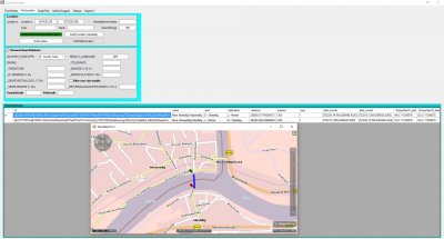
How about using the xLocate.findCombinedTransportByLocation method to look for a ferry?

- Sample screenshot taken from xLocate testclient.
Result shows some ferry relations near the given input coordinate.
Furthermore you could use the StaticPoiLayer as described here:
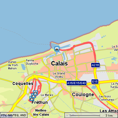
Combined transport is a function to add ferries or piggybacks to the route planning as additional stations. Ferries and piggy back stations are displayable as a StaticPoiLayer that is named combined transports. Please note that combined transports are supported only by maps 2012.1 or newer.

- screenshot taken from the API documentation (usecase "How to Display Ferries and Piggy Back Stations")
- xMap_combinedtransport.gif (27.78 KiB) Viewed 5802 times
Best regards
Bernd