Page 1 of 1
Draw route on the map
Posted: Thu Jun 02, 2016 8:39 am
by VPlachy
Hello
When planning a route for transit point, which lies off the road does not draw on a map the route. In Map & Guide Internet is route draw Ok. Why is it like this? Any wrong setting?
Wrong
 Good on Map & Guide Internet
Thank you
Vladimír
Re: Draw route on the map
Posted: Tue Jun 07, 2016 8:47 am
by Bernd Welter
Hello Vlad,
how about this approach:
- Use the RoutingOption.GENERATE_EXTWAYPOINTS=TRUE
- This will extend the response and tell you the LOCATION coordinate and the so-called MATCH coordinate for each waypoint.
- With this additional information you can paint the missing connection between input coordinates and the routing polygon.
 Viewed 6896 times")
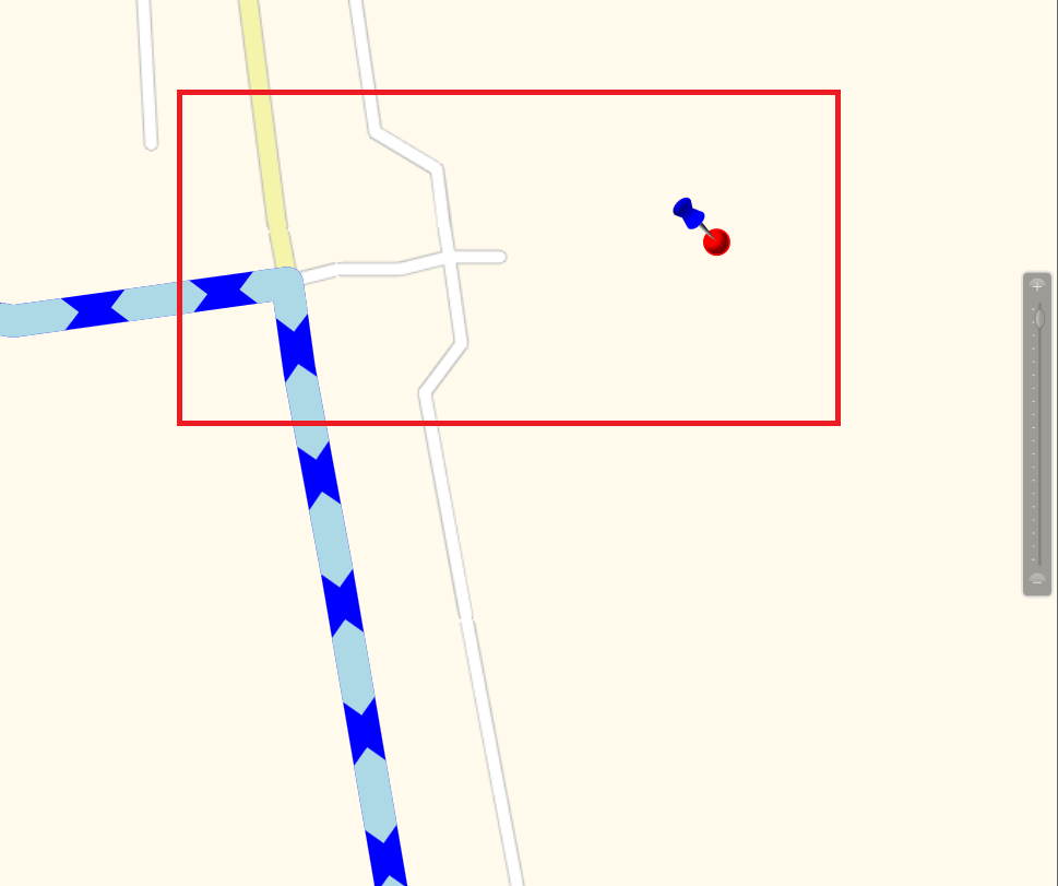
- The image shows the distance between LOCATION COORDINATE and MATCH COORDINATE. If necessary you can paint this airline connection.
Best regards Bernd
Re: Draw route on the map
Posted: Tue Jun 07, 2016 9:19 am
by Bernd Welter
And here is a little example, the yellow cross is the input coordinate.
The red line is your goal.
 Viewed 6894 times")
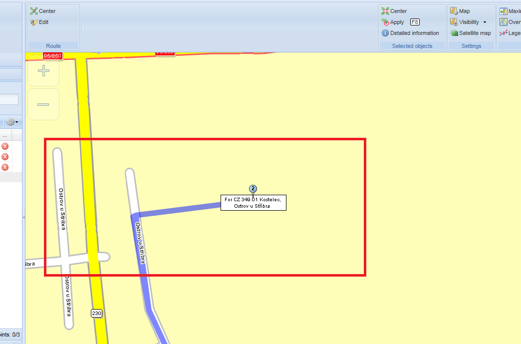
- Little proof: the blue line is the polygon returned by the server.
The red line is the overlay of POLYGON and LINKING DISTANCE. Looks fine in my eyes.