Page 1 of 1
Road used inaccessible by truck
Posted: Thu Apr 09, 2020 8:35 am
by driesdesmet
Hello,
This might be a nitpicky question but I'm investigating the API & was testing the calculateRoute with some data and received some strange results. I'm wondering if this is a request issue, or missing data on your provider side.
(Doing a simple REST call with start location lat: 50.890830 lon: 3.981790 & end: lat: 50.951401 lon: 3.806740 )
(The call itself:
https://xserver2-europe-eu-test.cloud.p ... rredRoutes)
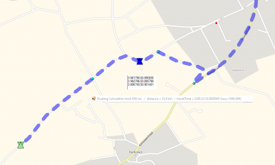
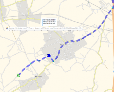
Now this ends up with this part of the polyline mapped to google maps + streetview of the issue.
In the first place I'm curious why it would route through that street as to get to the primary/secondary road it would be more efficient to just drive straight + the road it takes will not be possible to turn into.
Re: Road used inaccessible by truck
Posted: Thu Apr 09, 2020 9:11 am
by Bernd Welter
https://www.google.de/maps/@50.8977092, ... 384!8i8192
Not sure whether I got it right but driving straight ahead would end up in a wrong direction of a one way road
Re: Road used inaccessible by truck
Posted: Thu Apr 09, 2020 9:37 am
by driesdesmet
ah hmm, that changed about 6 months ago (I live in the area), but still, the right turn before that forbidden sign would have been the route you take
Re: Road used inaccessible by truck
Posted: Thu Apr 09, 2020 10:26 am
by Bernd Welter

- 25.3km / 2019 seconds

- 25.4km / 1998 seconds
I added some additional points to enforce specific directions.
The unwanted geometry is 100m longer but requires 20 seconds less than the one you want to get.
So if you push towards "driving time " (distanceTimeWeighting towards 0) you might get the track that you want.
But: The REST api does not support extensive parameters. If you want to access them you need to use WSDL/SOAP or JSON...
Feedback is welcome

Best regards,
Bernd
PS: if the data situation is not up 2 date get in touch with your local support. The colleagues will gather the situation and forward it to our providers.
Re: Road used inaccessible by truck
Posted: Thu Apr 09, 2020 11:53 am
by driesdesmet
Ok thanks, but in your first example it will still use a road that should be inaccessible by a truck due to its attributes, should I check this with our local support then?
Re: Road used inaccessible by truck
Posted: Thu Apr 09, 2020 12:08 pm
by Bernd Welter
oh yes please. It looks like both the Google Maps Streetview and our data is outdated.
There's no sign that prevents a 40t truck from driving there, is it?
I will let Joost know about that...
Re: Road used inaccessible by truck
Posted: Thu Apr 09, 2020 12:21 pm
by driesdesmet
no signs, but physically it'll be impossible to go through, but I guess that truck attributes works based on signs/indications that certain roads are off limit? (Not too important, just found it weird that it would send a truck that way, trying to understand if my request/layers were correctly setup)
Re: Road used inaccessible by truck
Posted: Thu Apr 09, 2020 12:29 pm
by Bernd Welter
I completely understand your doubts.
We just buy the data from players such as HERE and TOMTOM, and they probably get them from the administrations.
So if there's no official law we won't be able to consider the geometry of a truck.
Worst case someone should tell the administration that a sign would be a good idea.
Once it is set up the data providers might add it to their data and then it will be considered on official way.