StaticLayer CombinedTransports (xMap 1.x)

This forum covers all questions dealing with visualization of data within the native PTV xMap interface and the
PTV Developer Raster Maps API
Please remember that additional plugins such as AJAX or Leaflet may be handeled in other forums.
Post Reply
User avatar
Bernd Welter
Site Admin
Posts: 2703
Joined: Mon Apr 14, 2014 10:28 am
Contact:

StaticLayer CombinedTransports (xMap 1.x)

Post by Bernd Welter »

Hi there,

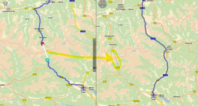
just for your information: our xMap server is able to visualize not only a thin polygon line for the ferries but also icons for various combined transports such as Ferries and PiggyBacks.
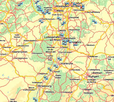
  • Ferries - just a rough overview of some national ferries in the Rhein-Neckar-Area
    Ferries - just a rough overview of some national ferries in the Rhein-Neckar-Area
  • PiggyBacks (Austria) - also included in the routing polygon / geometry
    PiggyBacks (Austria) - also included in the routing polygon / geometry
Just use the static layer "combinedTransports" and apply the render profile "CombinedTransports".

Best regards,
Bernd
Bernd Welter
Technical Partner Manager Developer Components
PTV Logistics - Germany

Bernd at... The Forum,LinkedIn, Youtube, StackOverflow
I like the smell of PTV Developer in the morning... :twisted:
Post Reply