Page 1 of 1
onlyReachableRoads Car Profile Parameter
Posted: Fri Dec 01, 2017 2:08 pm
by PaulBuechs
Hi,
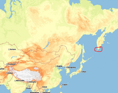
we are facing an issue about routing in Russia region kamchatka. After Bernd suggestet Parameter onlyReachableRoads we get expected outcame. But we are not sure about the influence of this parameter to our normal tour planning.
We need an explanation of this parameter.
Kind regards,
Paul
Re: onlyReachableRoads Car Profile Parameter
Posted: Fri Dec 01, 2017 2:44 pm
by Joost
There are parts of the map where if you consider your vehicle that will be isolated from other parts of the map. A simple example to illustrate this:
The inner city of Utrecht is closed of by retracting obstacles that you are only allowed to pass if you have a special key. Screenshot:
For sake of argument assume you have your vehicle configured to "not allowed to pass these objects". So a route from inner city to inner city can be calculated, from outer city to outer city can be calculated. But router from inner to outer or visa versa cannot be calculated.
This can be problem if you are routing from city to city (no street information) and the city point happens to be in such an isolated area. And in previous versions of our software this was a problem. What we do now to counter this effect is that when we are creating a map we check for each segment if you can reach the main road network or not. If you cannot reach the network we mark the segment in the map data. This is where the option onlyReachableRoads comes into effect. If this option is set to false our engine will connect your waypoint to the nearest road where the vehicle is allowed on. If this option is set to true it will connect the waypoint to the nearest road that your vehicle is allowed on AND has the "reachable from main road flag" set.
Thie means with onlyReachableRoads = false an outer to inner city route will fail to calculate, with onlyReachableRoads = true the router will connect the waypoint in the inner city to the closed outer city segment it can find and route from there. Closed is this context is detemined by airline distance.
Looking specifically to your example: you wrote that you are routing in Russia. The map data in Russia does not have complete coverage of all the know roads. Sometimes this creates isolate area's in the map especially when trying to route to smaller villages. Setting onlyReachableRoads to true will at least find the nearest main road so that you can calculate your route.
Last comment: it is not possible to visualize the flag to get an idea is a area is isolated or not. I would strongly advise to always keep onlyReachableRoads on true. If there is a reason why you vehicle is allowed inside an isolated area our engine will pick up on this.
Re: onlyReachableRoads Car Profile Parameter
Posted: Fri Dec 01, 2017 3:10 pm
by Bernd Welter
PERFECT ANSWER, Joost!
I love such teamwork!
The generic aspect is therefore solved but unfortunately the context of the customers map is quite important:

- target region: the peninsula. Many sub regions over there are marked as "not reacheable" in the map. Our data department will check whether it makes sense to treat the region different in future maps.
I'm in touch 1:1 with Paul and Chris to check this topic,
Thanks so far,
Bernd