This forum deals with any kind of routing computation whether it is simple A:B-routing, calculation of isochrones, simple matrix computation or nearest search.
Hello
When planning a route for transit point, which lies off the road does not draw on a map the route. In Map & Guide Internet is route draw Ok. Why is it like this? Any wrong setting?
Wrong
Good on Map & Guide Internet
Thank you
Vladimír
Vladimír Plachý, DiS. Developer windows applications
D&Comm s.r.o. - Czech Republic
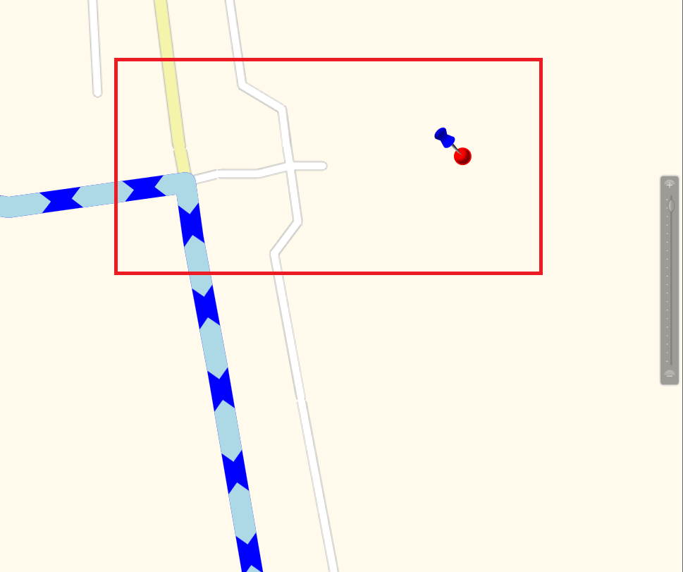
This will extend the response and tell you the LOCATION coordinate and the so-called MATCH coordinate for each waypoint.
With this additional information you can paint the missing connection between input coordinates and the routing polygon.
The image shows the distance between LOCATION COORDINATE and MATCH COORDINATE. If necessary you can paint this airline connection.
Best regards Bernd
Bernd Welter Technical Partner Manager Developer Components
PTV Logistics - Germany
Bernd at... The Forum,LinkedIn, Youtube, StackOverflow
I like the smell of PTV Developer in the morning...
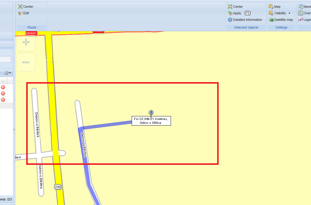
And here is a little example, the yellow cross is the input coordinate.
The red line is your goal.
Little proof: the blue line is the polygon returned by the server. The red line is the overlay of POLYGON and LINKING DISTANCE. Looks fine in my eyes.
Bernd Welter Technical Partner Manager Developer Components
PTV Logistics - Germany
Bernd at... The Forum,LinkedIn, Youtube, StackOverflow
I like the smell of PTV Developer in the morning...